Strategic Land Assembly & Management
Land fragmentation is the primary barrier to regional development. SOAR CIC serves as the centralized vehicle for property acquisition, survey, and lot consolidation. Operating under Ohio Revised Code 1724, we possess the statutory authority to acquire and dispose of real property without the constraints of public bidding, allowing us to move at the speed of the private sector.
Core Capabilities
Agile Acquisition & Disposition
Image: Use the “Westwinds Planning Area Map” (Comp Plan Page 42) showing the expansion parcels.
Pre-Development Engineering
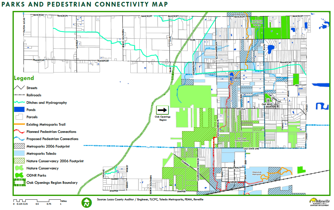
Image: Use the “Infrastructure Conditions Map” (Comp Plan Page 36) showing water/sewer lines.
Current Strategic Targets
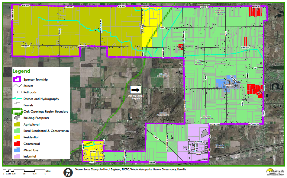
1. The Westwinds Expansion We are actively managing the annexation and assembly of the 38-acre township-owned parcel located at the northeast corner of Shaffer and Whitehouse-Spencer Road. This strategic acquisition is designed to connect directly with the existing industrial park footprint, unlocking critical inventory for mid-sized logistics facilities.
- Status: Pre-Development Engineering
- Learn More: View Westwinds Zone Profile
2. Spencer-Sharples Town Center Our focus is on assembling underutilized and fragmented parcels near the intersection of Angola and Irwin Roads. The goal is to create a unified, shovel-ready site for mixed-use commercial development that supports the Oak Terrace neighborhood and creates a true “Town Center” civic hub.
- Status: Site Identification & Assembly
- Learn More: View Spencer-Sharples Profile
3. Northwest Agricultural Security Areas (ASAs) In the Northwest Planning Area, our “assembly” strategy is preservation-focused. We are working with contiguous landowners to aggregate the 500-acre minimum required to establish state-recognized Agricultural Security Areas (ASAs), protecting prime farmland from fragmentation.
- Status: Landowner Enrollment
- Learn More: View Agricultural Zone Profile
Site Selection
Are you a landowner looking to sell, or a developer looking for a site?